A project of

RICE logo
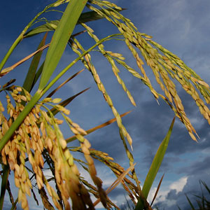
  • Rice is a type of grass (genus Oryza) that belongs to a family of plants that includes other cereals such as
    Read More

    Rice as a plant

  • Rice is the most important human food crop in the world, directly feeding more people than any other crop. In 2012,
    Read More

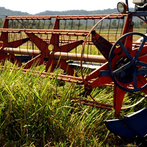
    Rice as a crop

  • Cultivating rice is the – and source of income – for millions of households around the globe. Rice is grown in more than
    Read More

    Rice as commodity

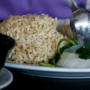
  • Rice is the most important food crop of the developing world and the staple food of more than half of the
    Read More

    Rice as food

  • Challenges

    Challenges

    For every one billion people added to the world’s population, 100 million more tons of rice need to be produced each year. But the challenges facing rice production are great. Read More
  • Culture

    Culture

    Rice is a central part of many cultures – some countries even credit rice cultivation with the development of their civilization. It is remarkable that almost every culture has its own way of harvesting, processing and eating rice and these different traditions are, in fact, part of the world's cultural heritage. Read More
  • Rice around the world

    Rice around the world

    Following are detailed descriptions of selected rice-producing countries in rice regions (Asia, Latin America and the Caribbean [LAC], Africa, North America, and Europe). Of the top 10 countries in the world during 2005-09, nine are in Asia, in order: China, India, Indonesia, Bangladesh, Vietnam, Myanmar, Thailand, Philippines, and Japan. Completing the top 10 Asian countries is Cambodia. Read More
gambia

General information

  • GNI per capita at PPP$, 2011: 2,060
  • Internal renewable water resources, 2011: 3 km3/year
  • Incoming water flow, 2011: 5 km3/year
  • Main food consumed, 2009: rice, millet and sorghum, oils and fats, sugar and sweeteners, wheat, maize, milk
  • Rice consumption, 2009: 60.6 kg milled rice per person per year

Production seasons


Planting

Harvesting

Main
May-Jun
Oct-Nov
Off
Jan-Feb
May-Jun


Write-up taken from the IRRI's Rice Almanac (2013):


The Gambia is a very small tropical nation of 11,300 km2, forming an east-west strip of land along the Gambia River to its mouth in the Atlantic Ocean. Senegal surrounds the country apart from its 80-km coastline. The vegetation is forest and rainforest but large areas have been deforested for firewood and agriculture. About 40% of the land is arable. In 2011, agriculture occupied 76% of the workforce in the population of 1.78 million and contributed 29.9% of GDP.

Source: FAOSTAT database online as of November 2012.


Return to world map

egypt

General information

  • GNI per capita at PPP$, 2011: 6,120
  • Internal renewable water resources, 2011: 1.8 km3/year
  • Incoming water flow, 2011: 55.5 km3/year
  • Main food consumed, 2009: wheat, tomatoes, fruits, maize, milk, rice, sugarcane, potatoes, meat
  • Rice consumption, 2009: 38.6 kg milled rice per person per year

Production season


Planting

Harvesting

Main
May
Oct


Write-up taken from the IRRI's Rice Almanac (2013):


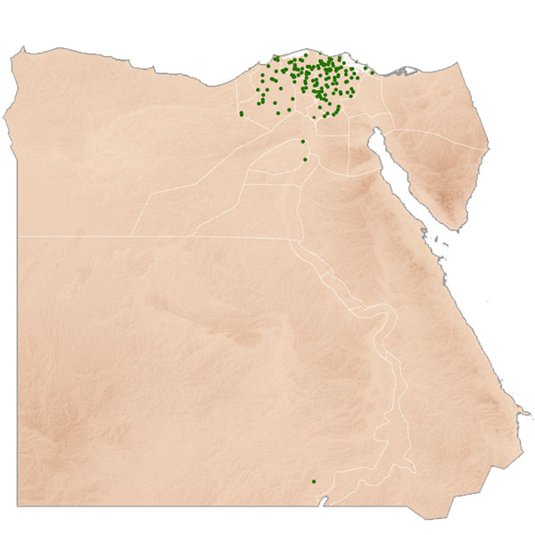
Egypt, a large nation of 1 million km2, mainly consisting of desert, is located in the northeastern corner of Africa. It has a fast-growing population, 82.5 million in 2011, almost all of whom live along the Nile River. The Nile’s waters are used extensively to irrigate crops such as rice, which is grown in the summer on about 600,000 ha, mainly in the northern delta. Arable land was 2.9% of the total area in 2009. A quarter of the workforce is involved in agriculture, which makes up 14% (2011) of GDP. 

Source: FAOSTAT database online and AQUASTAT database online, as of November 2012.


Return to world map

cote

General information

  • GNI per capita at PPP$, 2011: 1,730
  • Internal renewable water resources, 2011: 76.84 km3/year
  • Incoming water flow, 2011: 4.3 km3/year
  • Main food consumed, 2009: rice, cassava, yams, plantains, wheat, maize, vegetables, fermented beverages, sugar, palm oil
  • Rice consumption, 2009: 67.3 kg milled rice per person per year

Production seasons


Planting

Harvesting

Main, north
May-Jun
Oct-Dec
Main, south
Apr-May
Sep-Nov
Off
Dec-Feb
Apr-Jun


Write-up taken from the IRRI's Rice Almanac (2013):


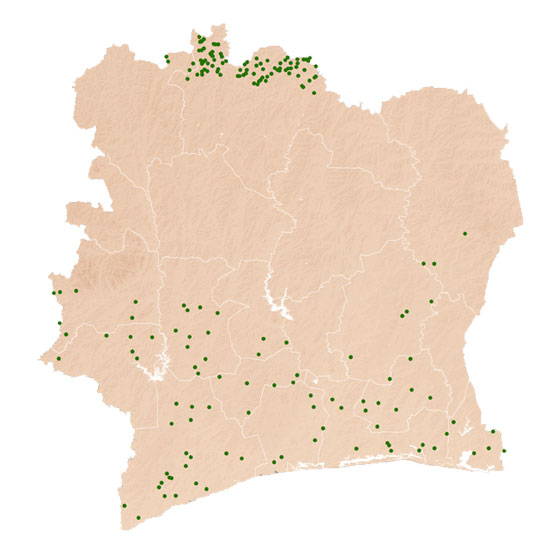
Côte d’Ivoire is centrally located along the southern coast of West Africa. Its borders are formed by Ghana to the east, Burkina Faso and Mali to the north, Guinea and Liberia to the west, and the Gulf of Guinea to the south. The country has two principal zones: the tropical rainforest to the south and the savanna to the north, in a total land area of 318,000 km2, of which arable land is 8.8% (2009). Toward the middle of the country, the terrain rises to a low plateau covered by a partially wooded savanna. Here, the annual rainfall totals 1,100–1,200 mm during the rainy season from April to October. The Ivorian population was 20.15 million in 2011, of which at least 3 million are immigrants from neighboring countries. Agriculture supports 38% of the population and produces 24% of GDP. Rice is the principal food crop grown in many areas and is one of the most important staple foods for the country’s urban population.

Source: FAOSTAT database online as of November 2012; Revised National Rice Development Strategy for the Côte d’Ivoire Rice Sector (NRDS 2012–2020), Ministry of Agriculture, National Rice Development Offi ce (NRDO), January 2012.


Return to world map

congo

General information

  • GNI per capita at PPP$, 2011: 350
  • Internal renewable water resources, 2011: 900 km3/year
  • Incoming water flow, 2011: 383 km3/year
  • Main food consumed, 2007: starchy roots, plantains, maize, nuts, fish, bananas 
  • Rice consumption, 2007: 7.0 kg milled rice per person per year

Production seasons


Planting

Harvesting

Main, north
Jan-Mar
Jun-Jul
Main, south
Sep-Oct
Feb-Mar


Write-up taken from the IRRI's Rice Almanac (2013):


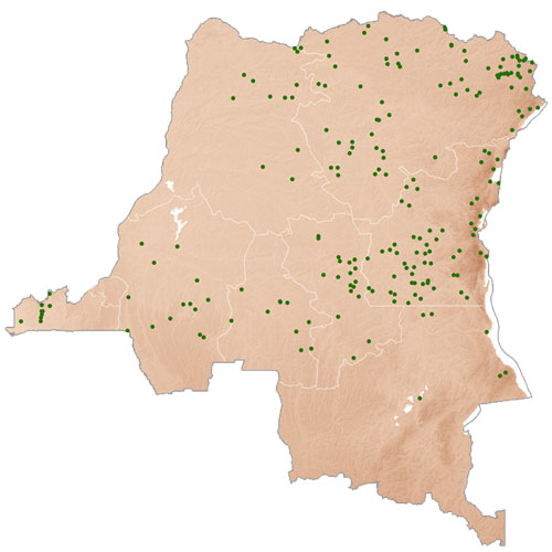
The Democratic Republic of the Congo, formerly Zaire, is a large central African country with a narrow corridor of land to the Atlantic Ocean with an area of 2,344,860 km2. Its population was 67.8 million in 2011. The center and the northern parts of the country are covered in rainforest (but which is rapidly disappearing) and are sparsely populated, mainly by subsistence farmers. In the south are extensive grasslands where the bulk of agriculture is carried out. Agriculture constituted 43% of GDP in 2009, occupying some 57% of the workforce.

Source: FAOSTAT database online and AQUASTAT database online, as of November 2012.


Return to world map

If you want to learn more, please read the Rice Almanac. You can purchase it on Kindle or download for free as a PDF.

In partnership with:

IRRI-logo
logo-africarice
CIAT-logo