General information
- GNI per capita PPP$, 2011: 1,370
- Internal renewable water resources, 2011: 15 km3/year
- Incoming water flow, 2011: 28 km3/year
- Main food consumed, 2009: sorghum, millet, yams, cassava, nuts, oil crops, meat, maize, wheat
- Rice consumption, 2009: 7.1 kg milled rice per person per year
|
Production seasons
| |
Planting
|
Harvesting
|
| Main |
Jun-Jul
|
Oct-Dec
|
| Off |
Jan-Feb
|
May-Jun
|
|
The Republic of Chad is a landlocked country of 1,259,200 km2 in the Sahel region of Africa. The country is divided into three regions: desert (the Sahara) in the north, occupying 40% of the total area; plains in the central part, used mainly for grazing; and fertile lands in the south that are more tropical and on which most of the 11.5 million population lives. Agriculture is a dominant force in the economy at 51% of GDP, with 66% (in 2010) of the population engaged in agricultural activities. Arable land, however, is only 3.4% of its land area.
Source: FAOSTAT database online and AQUASTAT database online, as of November 2012.
General information
- GNI per capita PPP$, 2011: 2,360
- Internal renewable water resources, 2011: 273 km3/year
- Incoming water flow, 2011: 12.5 km3/year
- Main food consumed, 2009: cassava, plantains, maize, bananas, sorghum, vegetables, rice, pulses
- Rice consumption, 2009: 30.3 kg milled rice per person per year
|
Production seasons
| |
Planting
|
Harvesting
|
| Main |
May-Jun
|
Oct-Nov
|
| Off |
Jan-Feb
|
May-Jun
|
|
Cameroon is a West African nation bordering the Atlantic Ocean, with an area of 475,440 km2. Cameroon is one of the best-endowed countries in sub-Saharan Africa in natural resources. About half of the workforce is employed in agriculture, which makes up about 20% of GDP. The country has three regions: northern plains, central grasslands, and rich farmlands in the south, where most of the 20.03 million (2011) population lives. About 12.6% of the land is arable. This area is under threat of drought and desertification.
Source: FAOSTAT database online and AQUASTAT database online, as of November 2012.
General information
- GNI per capita at PPP$, 2011: 610
- Internal renewable water resources, 2011: 10.06 km3/year
- Incoming water flow, 2011: 2.48 km3/year
- Main food consumed, 2009: bananas, starchy roots, vegetables including oils, beans, maize, fermented beverages, fruits
- Rice consumption, 2009: 6.4 kg milled rice per person per year
|
Production season
| |
Planting
|
Harvesting
|
| Main |
Oct-Dec
|
May-Jun
|
|
Burundi, at the northern end of Lake Tanganyika in Central Africa, is a landlocked country with a land area of 25,680 km2, most of which is mountainous, with some plains and with a plateau in the east. Burundi borders Tanzania, the Democratic Republic of the Congo, and Rwanda. Although the country is near the equator, the climate is moderate because the average altitude is 1,700 m. Rainfall is characterized by alternating dry and rainy seasons. Unusually, there are two wet seasons (February-May and September-November) and two dry seasons (June-August and December-January). Arable land is 35% of land area. The great majority (89%) of the population of 8.6 million (2011) is rural, occupied in agriculture that accounts for 35% of GDP.
Source: FAOSTAT database online and AQUASTAT database online, as of November 2012.
General information
- GNI per capita at PPP$, 2011: 1,310
- Internal renewable water resources, 2011: 12.5 km3/year
- Incoming water flow, 2011: 0 km3/year
- Main food consumed, 2009: sorghum, millet, maize, rice, oil crops, groundnuts, vegetables, pulses, meat
- Rice consumption, 2009: 25.5 kg milled rice per person per year
|
Production seasons
| |
Planting
|
Harvesting
|
| Main |
May-Jun
|
Oct-Nov
|
| Off |
Jan-Feb
|
May-Jun
|
|
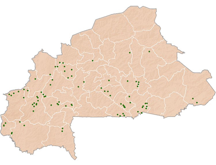
Burkina Faso, previously Upper Volta, is a landlocked country bordered by Benin, Côte d’Ivoire, Ghana, Mali, Niger, and Togo. Its 17 million (2011) people live in an area of 274,220 km2, making it one of the most densely populated countries in the Sahel. The land consists of rolling plains dissected by valleys formed by upper reaches of the Volta River. Agriculture occupies 92% of the working population, contributes about 33% of GDP, and provides more than 85% of export earnings (2011), although only about 21.6% of the land (2009) is arable. Further, substantial desertification has occurred as a result of previous inappropriate farming techniques used for peanuts and cotton for export. Deforestation has also been rampant, resulting in a lack of fuel wood.
Source: FAOSTAT database as of November 2012. *Irrigated rice occupied on average 23% of the rice area in 1984-2009 and provided nearly 53% of the national production of rice, according to the Direction Générale de la Promotion de l'Economie Rurale.

